How Portland’s Street Grid Shaped Its Neighborhoods
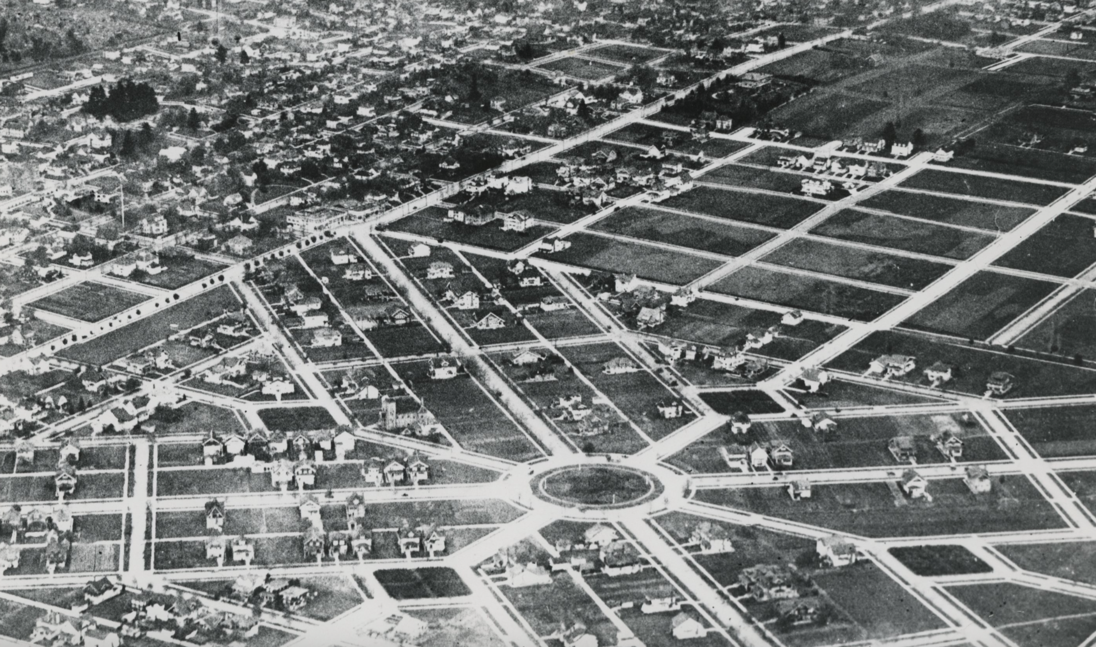
Many buyers exploring Portland notice something quickly. The neighborhoods often feel easy to navigate on foot.
Streets connect in predictable ways. Blocks are relatively short. Shops and cafes tend to appear along natural corridors rather than isolated commercial centers. That experience isn’t accidental. Much of it comes from a design decision made more than a century ago: Portland’s street grid. Understanding how that grid shaped the city helps explain why some neighborhoods feel the way they do today.
I. Portland’s Blocks Are Smaller Than Most American City Blocks
Portland’s downtown blocks measure roughly 200 feet by 200 feet, significantly smaller than the blocks found in many other U.S. cities.
This design dates back to the city’s earliest planning decisions in the mid-1800s. Smaller blocks create more intersections and more possible routes through a neighborhood. That increases:
walkability
storefront exposure for businesses
route flexibility for pedestrians and cyclists
In contrast, cities built with larger blocks often funnel traffic into a smaller number of major streets, which can make neighborhoods feel more car-dependent. Portland’s grid allows movement to distribute more evenly across streets.
II. Why Eastside Neighborhoods Feel Especially Walkable
Many of Portland’s eastside neighborhoods were developed during the late 19th and early 20th centuries, when street grids were the dominant planning model for American cities. These neighborhoods typically feature:
consistent block sizes
connected streets
mixed housing types
neighborhood-scale commercial streets
As a result, it’s common to see small business districts embedded naturally within residential areas. Places like neighborhood cafes, corner markets, and restaurants can emerge without requiring large commercial developments. The grid quietly supports those patterns.
III. The Role of Commercial Corridors
Even within the grid, certain streets evolved into commercial corridors. These corridors often formed along:
historic streetcar lines
wider arterial streets
intersections connecting multiple neighborhoods
Over time, businesses clustered along these routes because they captured more passing activity. Many of Portland’s best-known neighborhood business districts reflect this pattern today. Examples include:
NW 23rd Avenue in the Alphabet District
SE Hawthorne Boulevard on the eastside
SE Division Street as it passes through Richmond and Hosford-Abernethy
Alberta Street in Northeast Portland
Mississippi Avenue in Boise
Each corridor developed slightly differently, but they share a similar underlying structure: residential neighborhoods surrounding a concentrated strip of restaurants, shops, and services. This pattern allows many Portland neighborhoods to support walkable local commercial districts without requiring large commercial centers or major retail developments.
IV. Where the Grid Changes
Not every part of Portland follows the same street grid.
In some areas, geography interrupted the pattern. In others, later planning decisions introduced curving streets, landscaped parkways, or suburban-style layouts that softened the traditional grid. You can see these shifts in several parts of the city.
In the West Hills, including areas such as Portland Heights, Council Crest, and parts of Southwest Portland, steep terrain forced streets to curve, climb, and adapt to the land rather than follow a strict grid.
In Laurelhurst, the street pattern becomes more picturesque and irregular, with curving roads and diagonal connections that reflect early twentieth-century neighborhood design rather than a rigid eastside grid.
In Eastmoreland and near Reed, streets become more landscaped and gently curved, creating a more residential and park-like pattern than the tighter grid found in much of the inner eastside.
In parts of Northeast Portland, including areas around Alameda, Beaumont-Wilshire, and Rose City Park, topography and ridgelines interrupt the regular grid, producing angled streets, unusual intersections, and neighborhood edges that feel different from the flatter eastside blocks.
In Outer East Portland, especially in areas developed later in the twentieth century, the pattern often shifts again toward longer blocks, curving streets, and cul-de-sacs.
Each of these patterns reflects the era and physical conditions under which those areas were developed.
Those differences influence how a neighborhood feels day to day. Areas with a tighter grid tend to support easier walking and cycling, with more route options and a stronger sense of connectivity. Areas where the grid bends or breaks often feel quieter or more residential, but they may also require more driving for daily errands.
V. Looking Beneath The Surface
Real estate decisions are often influenced by factors that aren’t immediately obvious.
Urban design patterns, transportation history, and land development decisions made generations ago still shape the neighborhoods people experience today. Understanding those underlying systems helps buyers evaluate neighborhoods more thoughtfully.
⬧ What This Means for Buyers
For buyers, the street grid isn’t something most people evaluate consciously. But it quietly shapes everyday experience. It influences:
how easy it is to walk to nearby amenities
how traffic flows through a neighborhood
how businesses develop over time
how connected a neighborhood feels
Two homes with similar square footage and price can offer very different lifestyles depending on how the surrounding streets are organized.